The Geopolitics of Joda … Military Geography
Ali Abdul Latif

In 1917, the President of the American Geographers Association encouraged geographers to put their knowledge of geography at the service of their government in order to wage successful wars…
The development of the concept of (Military Geography) Geopolitics… helped geography establish a fundamental depth for all military movements and the course of military operations,,,
As the land with its natural and human realities represents a theater for military operations, and military geography determines the main axes on the battlefronts…
Since the dawn of history, geographical information has been an important element of military conflict,,,
Military operations take on a geographical character because they take place on a certain site,,, and that site has its own distinctive natural environment and climate,,,
The battlefront extends to supply and provisioning sites via land and air,,, battles and supply consist from a geographical perspective of time, distance, and the nature of the prevailing conditions within the framework of that specific time and distance, in addition to factors of movement and natural obstacles..
Dr. Qasim Al-Duwaikat in his book “Military Geography” mentioned that the general shape of the State either grants it a power that enhances its military position or weakens its power and threatens its steadfastness,,,
An example of which is countries that extend longitudinally (north-south) such as Chile – Norway – Sweden – Malawi… or (east-west) such as Russia – Panama… The shape makes it difficult to protect the borders.. and exacerbates internal problems… as Ukraine is currently doing on the Russian borders…
The cohesive shape with circular or square edges is characterized by short borders in relation to the total area of the State’s territory,,,
This shape facilitates the process of controlling the parts of the State, for example (France – Egypt – Libya) as this shape facilitates the armies’ internal control over parts of the State,,, and facilitates the process of defending it,,, in addition to providing strategic depth for military maneuvering in cases of war…
There is a shape called the dispersed or sectioned, in which the State consists of a number of unconnected parts, separated by the sea or by other countries,,,
For example: Indonesia, Malaysia, and Italy,,, and the disadvantages of this form of States are the difficulty of controlling and defending against any external threat. In addition, it is far too easy to cut off any part of the State from the center during war…
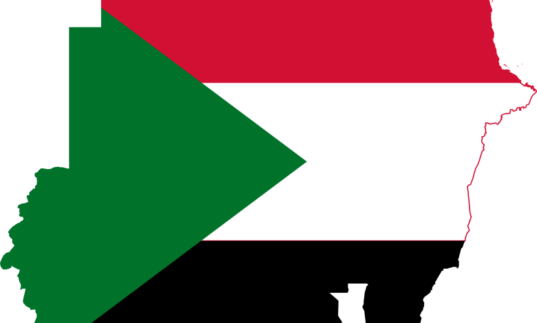
As for the fourth form, it is what we currently have in Sudan, which is irregular,,,
Where some regions of the State enter into another State in the form of sectors and tips, or its borders are dented inward to allow the region of another neighboring State to penetrate its borders, such as the Democratic Republic of the Congo and Myanmar,,,
The irregularity and overlapping of borders confuse the defensive process, as it is easy to cut off from the State… Moreover, the inability to extinguish wars in it,,, as supply points expand in the case of internal wars, especially with the different geographical borders of plains, mountains, and waterways.. In addition, such a State form lacks strategic depth…
There are various other forms and what -truly- distinguishes wars remains ti be geography.. and studying the plain nature and weak points by ascertaining the overall reality from a general perspective of the state’s form…
The advancement of the Rapid Support Forces and their complete control over the borders is geopolitics.. for the nature and geography of Sudan… The Joda border crossing represents the cornerstone of the country’s geographical nature..
The supplies and logistics that constitute the main source of strength in battles and breaches depend mainly on the geographically diverse borders and the diversity of crossings as well as their geographical nature.
Nature imposes a special type of resistance and prevention of supply, and this makes it only more difficult to prevent supply in the event of.. the multiplicity and diversity of geography as well…
When I wrote (Isolated Islands) as my own war strategy at the beginning of the war.. in addition to the broad knowledge of the geography of the continent, the world and certainly Sudan more precisely.. I reviewed numerous sources in military sciences, the most important of which are military geography, tribal diversity and the population structure in each region, which adds new dimensions on the war..
I can safely state that the war has approached its end militarily speaking, according to different geographical data and the collapse of the depth. In addition, the main force of the Army is concentrated in a narrow border strip with its weight leaning towards the east…
As usual, the Rapid Support Forces outdo themselves in the tactics of wars and the military geography that they apply, or rather, they apply it to perfection..
Four countries are completely out of service on the borders.. the most vital part has been controlled and remains in the center of this geography.. a location that represents the point of balance for the Army.. and in my view it’s the most important location in Sudan..
Do not forget, dear reader, that military geography determines the main axes on the front, upon which the forces are distributed by launching a direct attack on the opponent.. after appropriately identifying the areas of weakness,,,
Hence, you can control the sites or bypass them to reach behind their ranks to cut off the transportation and communication route. Thus paralyzing the supply and provisioning movements,
Military geography takes into account natural obstacles such as terrain and climate. …
The borders represent control.. the actual and operational superiority to wage the last war.. According to the location of Sudan, the nature and shape of Sudan geographically in military geography, it is time to advise for the last time… the people of the East and the Army to surrender…
(In my book, The Isolated Islands, a full detail of the geography of war in Sudan will be published soon)


